![]()
Saline Valley Road
Ride Date: | November 2024 |
What we rode: | Scott Addict |
Our tires: | Front: 44mm knobby tire Rear: 40mm knobby tire |
What tires we recommend: | The closest thing to mountain bike tires as you can run. |
What is the surface like?
Like every climb in Death Valley, you’ll encounter a range of surfaces along the same road. We recommend coming prepared with the “beefiest” rig you can run… and a spare tire or two.
It seems like a lot of Death Valley climbs are horrendously bad at the bottom and then actually slowly get better and less rocky towards the top… opposite of your typical gravel road. The reason is because of flooding. The floods are so chaotic and powerful here that every time it rains, all of the roads, especially these back roads that aren’t maintained, are absolutely obliterated by everything that’s on top of the mountains. Knowing the short term history of the weather (at least a few months) and doing your research on park road conditions and closures is critical for riding here.
View the Images tab in our Profile Tool for more detailed information on the road surface.
![]()
Climb summary by Sam Lyons (@sam.lionman)
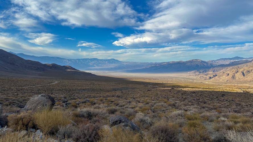
North of Death Valley National Park lies miles and miles of… nothing. The Death Valley Wilderness is one of the most remote, quiet places in the country. The only people you’ll see back here are campers and other adventurers.
![]()
![]()
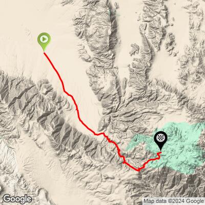
Even though the climb starts lower than where our route starts, the valley bottoms out so gradually that starting the climb at the lowest point in the valley would add roughly 7 miles of almost flat terrain.
![]()
A rockpile marks the start of our segment.
The silent, sweeping vista at the bottom is among the most special experiences I’ve had on a bike. Being in that wide open plain felt like a spiritual experience. You can really feel the wild freedom of the American west.
![]()
In and below the canyon, the roadway varies between extremely rocky and bumpy and pretty good. Check out the Images tab in the profile tool for geotagged photos of the surface.
![]()
![]()
The surface of Saline Valley, being one of the more well trafficked roads in the DV wilderness, is a lot better than you’ll find in other places. Especially as you climb up, most places it’s pretty smooth, with not a lot of pebbles. There was some sand, but when we rode it was packed down pretty well by cars, and the wash boarding wasn't that bad.
![]()
When you reach the left turn at the top of the first pass, it makes the whole climb up till that point worth it. You get one of the most spectacular views of Panamint Valley that you can get anywhere:
![]()
![]()
![]()
A beautiful view looking back down the canyon into the Saline Valley, too:
![]()
The surface from here gets a little messier, but more notably, this is really when it starts to get really, really steep, with the last mile averaging over 10%.
![]()
But of course, it goes back and forth from bad to nice…![]()
A short and steep descent tells you you’re halfway through the hard part.
![]()
Snow in Death Valley!
![]()
Done this climb? Leave a review!
Links:
Learn about PJAMM’s Surface Index
Learn about PDI (PJAMM Difficulty Index)
![]()