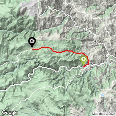
15.3
PDI
4.7 mi
DISTANCE
1,999 ft
GAINED
8 %
AVG. GRADE
FULL CLIMB STATS
Page Contributor(s): Christopher Jacobs - Boulder, CO
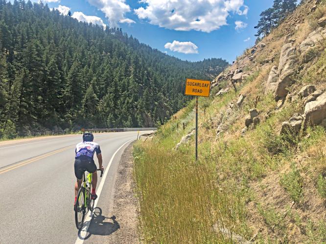
INTRO
This is a tough climb just west of Boulder and just across the street from an even more challenging (and more scenic) climb - Magnolia Road.
PLAN YOUR ROUTE
This climb has an average grade of 8%. 52% (2.4 miles) is at 5-10% grade and 29% (1.4 miles) is at 10-15%. Steepest quarter-mile 12.8% and steepest mile 11.1%.
See more details and tools regarding this climb's grade via the “Profile Tool” button.
Roadway: Two lane road in good condition with a narrow shoulder most of the climb.
Traffic: Minimal.
Parking: Across the street from the start of the climb - Map; Street View.
Provisions: None on this route - closets food and beverages are 6 miles east in Boulder.
Before heading out on any cycling adventure check out our Things to Bring on a Cycling Trip and use our interactive check list to ensure you don't forget anything.
This climb is in the center of the bike universe - the unbelievably bike friendly Boulder Colorado (See PJAMM's Boulder, CO climb area page for more details). See Routes in Area for the proximity of other climbs to this one. Just across Boulder Canyon Drive is the US #121 Magnolia Road. You can ride to these bike climbs via the Boulder Canyon climb, although there is a lot of moderately traveling motor vehicle traffic on that route.
ROUTE MAP
MEMBER RATING
CURRENT WEATHER
PJAMM TRIPS ADVENTURE STARTER BUNDLES
Check out PJAMM Adventure's prepackaged (self-guided) cycling trips. They will help you plan, document and conquer your next adventure.
NEARBY CLIMBS (0) RADIAL PROXIMITY
FROM No Climbs Found
MEMBER REVIEWS & COMMENTS
Let us know what you thought of this climb. Signup for our FREE membership to write a review or post a comment.
Already have an account?
LOG IN HERE