Page Contributor(s): Dan Razum, Campbell, CA, USA
INTRO
PLAN YOUR ROUTE
 We've partnered with Sherpa-Map.com to bring you the best route planning tool. With a PRO Membership you can use this climb as a reference when creating your route.
 ROUTE MAP


Page Contributor(s): Dan Razum, Campbell, CA, USA
 We've partnered with Sherpa-Map.com to bring you the best route planning tool. With a PRO Membership you can use this climb as a reference when creating your route.
Cycling Guadalupe Mountains National Park
Ride 9.7 miles to 5,830’ gaining 1,782’ at 3.2%
Visit our Guadalupe Mountains National Park page.
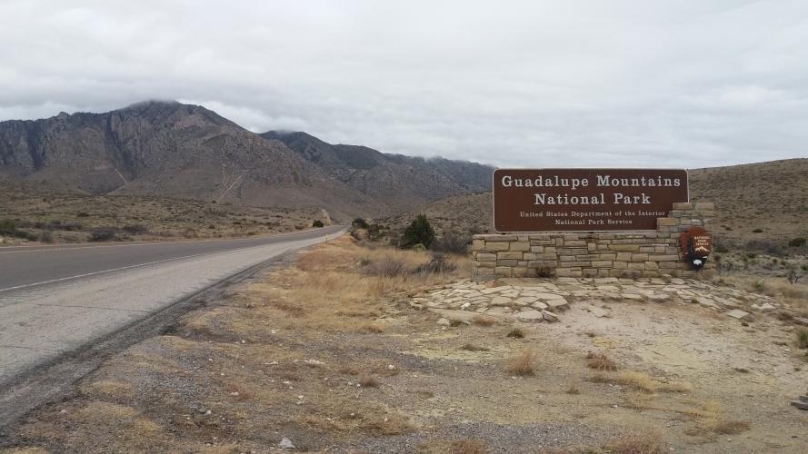
We ride along but only enter the national park at mile 8.2. Guadalupe Mountain National Park was established in 1972 and consists of 86,367 acres and is in the Guadalupe Mountains, home to Guadalupe Peak, the highest point in all of Texas.
This is a fairly remote climb (not even a full Strava segment for it) in east central Texas, 105 miles east of El Paso and the US border with Mexico.
Thank you to Dan Razum, Campbell, CA, USA for the following summary and all of the photographs for this climb.
The climb starts along route 62/180, at the intersection with route 54. Route 62/180 is a 3 lane highway and
traffic moves at highway speeds. Luckily, there isn't a lot of traffic and there is a generous wide shoulder
so the ride felt safe. However, it's always good to be alert when riding on highways and a flashing rear
light is recommended. There are "rumble strip" grooves at the edge of the shoulder, next to the roadway, to
alert motorists if they stray onto the shoulder but the grooves are very rough to ride over on a bike, so we
kept well on the shoulder to avoid the grooves. There is some debris and gravel on the shoulder, but not too
much, we had no problems riding on the shoulder the entire way. The roadway and shoulder are both in good condition.
Start of the climb.
Wide shoulder with rumble strip border.
The climb starts out fairly shallow as we ride towards the Guadalupe Peak. After a couple of miles the road gets
steeper as we start climbing to the base of the Guadalupe Mountains. Guadalupe Peak is an imposing view but we
don’t actually climb the peak, instead we circle around it as the road climbs up to a high plateau which is the
base of the mountains. Since we are climbing from a valley to a plateau, this is a "one sided" climb. In other
words, when we reach the top there isn't much descent on the other side, but rather rolling terrain for many
miles, without a large drop in elevation.
Guadalupe Peak as seen at 3.5 miles
Tallest point in Texas
Midway through the steeper section of the climb there is a picnic area with nice views of the valley below.
There is a second picnic area near the top, but without any views. After we reach the top of route 62 we turn
left to the Visitor Center and we can ride a little further to the Pine Springs Campground. There is water
available at the campground parking lot, as well as ample parking.
Road to the Visitor Center; .7 miles from finish of climb.
The scenery along the ride is enjoyable and the light traffic and wide shoulder help make the ride feel safe,
despite being a highway.
Great views of mountain formations along this bicycle ride.