
23.9
PDI
19.8 mi
DISTANCE
5,020 ft
GAINED
4.1 %
AVG. GRADE
FULL CLIMB STATS
INTRO
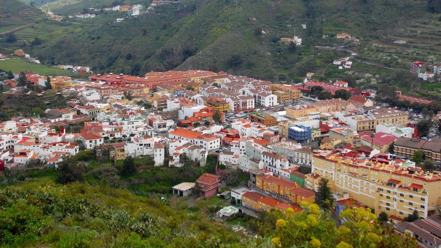
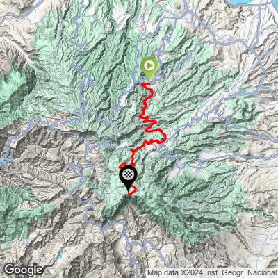
Teror - Cueva Grande is the long way from Teror to Pico de las Nieves, Gran Canaria's highest point: 31.9 km (19.8 mi) with 1,530 m (5,020 ft) of climbing, from 629 m (2,064 ft) on the edge of Teror to 1,936 m (6,353 ft) at the summit viewpoint. Where our Teror climb heads straight up the GC-21 through Valleseco to Cruz de Tejeda, this route swings south instead, over the ridge at San Isidro and down into the farming valley of Vega de San Mateo, before tackling the mountain from the east.
It rides like two climbs joined by a dip. The first 9 km (5.6 mi) on the GC-42 climb gently through the hillside hamlets of El Ojero and San Isidro to about 940 m (3,084 ft), then the road drops for about 4 km (2.5 mi) toward San Mateo. The second half is the real climb: from San Mateo the last 15.9 km (9.9 mi) average about 6.8%, first on the GC-15 and then on the quieter GC-600 through the scattered hamlet of Cueva Grande, where the grade settles into six straight kilometers of 7-9.5% through farmland and pine forest.
That upper half, San Mateo to the summit via Cueva Grande, is a well-known Strava segment in its own right, with pros training on the island among its fastest times. The finish is the fenced military summit of Pico de las Nieves, with the public viewpoint just below looking across the island to Roque Nublo and, on clear days, Mount Teide on Tenerife.
PLAN YOUR ROUTE
 We've partnered with Sherpa-Map.com to bring you the best route planning tool. With a PRO Membership you can use this climb as a reference when creating your route.
 This climb covers 31.9 km (19.8 mi) and gains 1,530 m (5,020 ft) at a 4.1% average grade, but that average includes about 223 m (731 ft) of descending, mostly in one block between San Isidro and Vega de San Mateo.
The first 9 km (5.6 mi) out of Teror are gentle, mostly 2-6%. From the high point near San Isidro the road descends for about 4 km (2.5 mi), then rolls through the edge of San Mateo at around 775-860 m (2,543-2,822 ft). From there the climbing is continuous: mostly 5-7.5% on the GC-15, then a steeper, sustained stretch on the GC-600 through Cueva Grande, where six straight kilometers from km 23 to km 29 average 7.1-9.5%. The final 3 km (1.9 mi) on the GC-130 and GC-134 ease slightly to 4-7%.
Steepest sections: 100 m (109 yd) at 11.9%, 0.5 km (0.3 mi) at 10.3%, 1 km (0.6 mi) at 9.7%, 2 km (1.2 mi) at 9.2%, 5 km (3.1 mi) at 8.6% and 10 km (6.2 mi) at 7.3%.
Roadway: Paved the entire way. The GC-42 from Teror to San Mateo and the GC-15 above San Mateo are regular two-lane roads; the GC-600 through Cueva Grande is a smaller mountain road climbing through farmland and then pine forest to meet the GC-130 near the summit plateau. The high roads around Pico de las Nieves (GC-130/GC-134) occasionally close briefly in winter for ice, and Gran Canaria's mountain roads can see rockfall closures after heavy rain, so check the Cabildo de Gran Canaria road updates before an off-season ride. Roads around Teror and San Mateo also close for timed stages during the Rallye Villa de Teror each September (25-26 September in 2026).
Traffic: Moderate on the GC-42, the main link between Teror and San Mateo, and busiest around San Mateo and on the GC-15, the main road from Las Palmas up toward Cruz de Tejeda. It thins out once you turn onto the GC-600 at Cueva Grande, then picks up again near the summit on weekends, when sightseers drive up for the view.
Parking: In Teror, the free Los Perales car park in the historic center is a short roll from the start (see our Teror climb page). To ride only the steeper upper half, start in Vega de San Mateo instead: the underground car park at the Plaza del Mercado is free on weekdays and charges a small all-day fee on weekends, and it's right next to the town's farmers' market.
Provisions: Teror has plenty of bakeries and cafes for a pre-ride stock-up. Vega de San Mateo, at roughly the halfway point, is the best refuel on the route - a full-service town with shops, bars and cafes, and a weekend farmers' market selling local produce. Above San Mateo there's little you can count on, so fill bottles there for the final 15.9 km (9.9 mi) and 1,077 m (3,533 ft) of climbing to the summit.
Gear: Bring layers. The north side of the island is often damp and cloudy at mid-elevations, and the summit at 1,936 m (6,353 ft) can be cold and windy, especially on the descent. The grades never get extreme, so a compact crankset with a mid-range cassette is plenty for the sustained 8-9% stretch through Cueva Grande.
Before heading out on any cycling adventure check out our Things to Bring on a Cycling Trip and use our interactive check list to ensure you don't forget anything.
This climb's best stop is Vega de San Mateo, the market town of Gran Canaria's central farmland. Its Mercado Agrícola y Artesanal runs on weekends - Saturdays from 8:00 to 20:00 and Sundays from 8:00 to 15:00 - with local growers and makers selling fruit, vegetables, other local products and crafts. Sunday morning is the busiest time, when visitors from across the island join the locals; Saturday is quieter if you want to browse without the crowds. The town sits in a green valley at around 800 m (2,625 ft), with the Iglesia de San Mateo at its center.
Teror itself - the basilica, the Fiesta del Pino and the Sunday market - is covered on our Teror climb page, which takes the more direct GC-21 route to the same summit. Riding both makes a good way to see the north side of the island from two different angles.
Pico de las Nieves can be climbed from nearly every side of Gran Canaria - see what's nearby and plan combinations with our Routes in the Area tool.
ROUTE MAP
MEMBER RATING
CURRENT WEATHER
PJAMM TRIPS ADVENTURE STARTER BUNDLES
Check out PJAMM Adventure's prepackaged (self-guided) cycling trips. They will help you plan, document and conquer your next adventure.
NEARBY CLIMBS (0) RADIAL PROXIMITY
FROM No Climbs Found
MEMBER REVIEWS & COMMENTS
Let us know what you thought of this climb. Signup for our FREE membership to write a review or post a comment.
Already have an account?
LOG IN HERE
