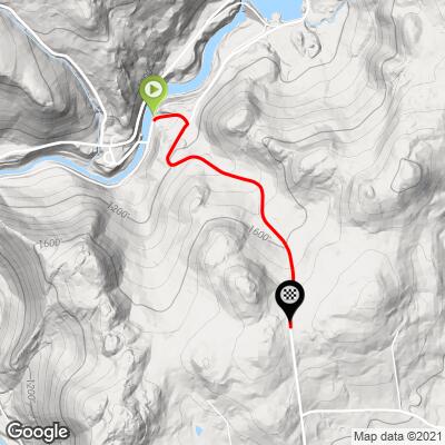
6.8
PDI
1.3 mi
DISTANCE
775 ft
GAINED
11.2 %
AVG. GRADE
FULL CLIMB STATS
Page Contributor(s): John Summerson, The Complete Guide to Climbing (By Bike), 2nd Edition
INTRO
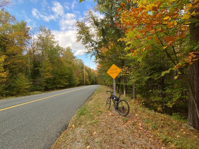
“Not quite as fearsome as nearby Kingsley Hill Road but no day at the park either. Monroe Hill Road is another short and very steep ascent near the scenic Deerfield River in northwestern Massachusetts. It is very interesting around the small dam that you must cross to get to its start (if coming from Monroe Bridge). Its steepest section near the bottom, you bear to the right about halfway up to find decreased grade and the listed climb ends at an unmarked but obvious top. This is also a very scenic climb that flows through thick woods over most of the route. Monroe Hill Road is a fast descent due to grade as well so watch the tight turn at the very bottom of the hill.” (This quote is provided with the approval of John Summerson from his book, The Complete Guide to Climbing (by Bike) in the Northeast, pg. 78.)
PLAN YOUR ROUTE
See more details and tools regarding this climb's grade via our interactive Profile Tool.
Information Not Available
If you have any information regarding this climb, we'd like to hear from you. Click the CONTRIBUTE button to share your thoughts with us.
Information Not Available
If you have any information regarding this climb, we'd like to hear from you. Click the CONTRIBUTE button to share your thoughts with us.
Before heading out on any cycling adventure check out our Things to Bring on a Cycling Trip and use our interactive check list to ensure you don't forget anything.
Information Not Available
If you have any information regarding this climb, we'd like to hear from you. Click the CONTRIBUTE button to share your thoughts with us.
ROUTE MAP
MEMBER RATING
CURRENT WEATHER
PJAMM TRIPS ADVENTURE STARTER BUNDLES
Check out PJAMM Adventure's prepackaged (self-guided) cycling trips. They will help you plan, document and conquer your next adventure.
NEARBY CLIMBS (0) RADIAL PROXIMITY
FROM No Climbs Found
MEMBER REVIEWS & COMMENTS
Let us know what you thought of this climb. Signup for our FREE membership to write a review or post a comment.
Already have an account?
LOG IN HERE