
16.2
PDI
4.9 mi
DISTANCE
2,217 ft
GAINED
8.7 %
AVG. GRADE
FULL CLIMB STATS
INTRO
On 19 July 2026 the Tour de France came back to the Salève for the first time since 1992, and race director Thierry Gouvenou explained the choice of road simply: the mountain has four good climbs, and they picked the steepest. This is it. From Le Coin the Route de la Croisette climbs 4.7 km at 11.2% to the col, and on stage 15 Quinn Simmons, who had attacked the breakaway on the way up, crossed the top first.
Our route starts lower, at Archamps, so the first 3 km are a gentle approach through the hamlets under the mountain - mostly around 5%, with a flat stretch around km 2.5. Then the road turns uphill at Le Coin and doesn't relent: from km 4 to 7.5 every half-kilometer is 11.3 to 12.4%, in hairpins cut through the forest on the Salève's western face. In all it's 7.8 km (4.9 mi) at 8.7%, with 676 m (2217 ft) of climbing.
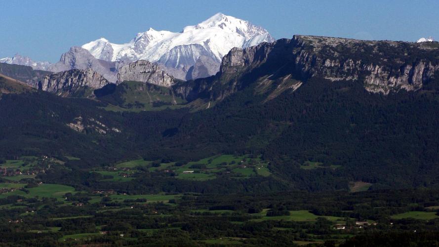
The col is a small place that gets busy on a sunny weekend: the hamlet of La Croisette, a restaurant with dozens of tables outside and a car park that fills up, with the open upper Salève beyond. On the way up you look west over Geneva and its lake to the Jura; walk a few minutes past the col and the view turns east to the Aravis and Mont Blanc.
PLAN YOUR ROUTE
 We've partnered with Sherpa-Map.com to bring you the best route planning tool. With a PRO Membership you can use this climb as a reference when creating your route.
Almost all of the climbing is in the last 4.8 km. From Archamps the first 3 km rise only 146 m: 4.5 to 5.4% for the first 1.5 km, a 7.9% ramp from km 1.5 to 2, and a near-flat 2.5% around km 2.5 to 3.
From Le Coin, at about km 3, it's 8.6 to 8.8% for a kilometer, then 11.3 to 12.4% from km 4 to 7.5 without a break. The steepest kilometer averages 12.1%, the steepest 2 km about 12% and the steepest 5 km 10.8%. The last 300 m ease to about 8% into the col.
Roadway: Sealed all the way. The roads through Vovray are ordinary village lanes; above Le Coin the Route de la Croisette (the RD45) is narrow, steep and twisty. Haute-Savoie relaid 4.5 km of it with fresh asphalt and rebuilt the shoulders in 2026, so the surface is about as good as it will ever be. The descent needs real care, with tight hairpins at 12%. In winter the col becomes a small cross-country ski spot, so expect snow and ice on the upper road in the cold months and check Haute-Savoie's road information before you go.
Traffic: Light to moderate. The Croisette is a popular outing from Geneva, and on fine weekends cars heading for the restaurants and walking trails fill the small car park at the col.
Parking: There's no parking set up at the start on the Route d'Annecy, by the Archparc business park, so leave the car in Archamps or Collonges-sous-Salève village and ride over (Street View on the Route de Vovray). From Geneva you can simply ride - Archamps is right on the Swiss border. Don't count on a space at the col on a sunny weekend.
Gear: Gear it as a short, very steep climb: about 4 km at 11 to 12% calls for your lowest ratio, and a 34x32 or 34x34 is sensible. Go easy on the gentle first 3 km - the work all comes after Le Coin.
Provisions: Stock up in Archamps or Collonges before you start; there's nothing on the climb. At the col, Les Marches de la Croisette serves traditional food with a big outdoor terrace and a mountain view, listed as open Wednesday to Sunday (closed Monday and Tuesday).
Before heading out on any cycling adventure check out our Things to Bring on a Cycling Trip and use our interactive check list to ensure you don't forget anything.
The Salève is Geneva's local mountain, and most riders who climb the Croisette are staying in the city or in Saint-Julien-en-Genevois, the easiest French base, with a train station a few kilometers from the start. From the col, roads drop the other way toward La Muraz and Monnetier-Mornex, so you can cross the mountain rather than come back down the same steep road. Our Le Grand Piton and Panorama sur les Alpes climbs cover the other roads on the Salève.
For non-riders in the group, the Téléphérique du Salève from Étrembières goes up to the summit plateau. On a rest day, the Maison du Salève at Présilly, below the mountain to the south, has exhibitions on the Salève's history and nature and is the start of several walks; it's closed on Mondays.
ROUTE MAP

MEMBER RATING
CURRENT WEATHER
PJAMM TRIPS ADVENTURE STARTER BUNDLES
Check out PJAMM Adventure's prepackaged (self-guided) cycling trips. They will help you plan, document and conquer your next adventure.
NEARBY CLIMBS (0) RADIAL PROXIMITY
FROM No Climbs Found
MEMBER REVIEWS & COMMENTS
Let us know what you thought of this climb. Signup for our FREE membership to write a review or post a comment.
Already have an account?
LOG IN HERE
