10.4
PDI
4.7 mi
DISTANCE
1,713 ft
GAINED
6.9 %
AVG. GRADE
FULL CLIMB STATS
INTRO
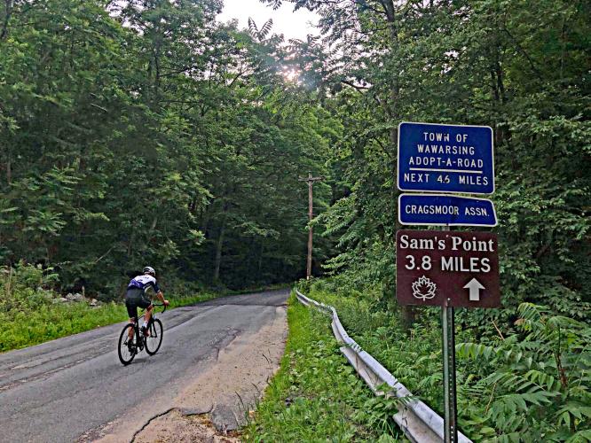
This is an little used route out of Ellenville in southeastern New York that shares its first 1.7 miles with Mt. Meenagha Road, another NY State Top 10. The roadway is minimally travelled and the climb is very quiet. We are surrounded by forest the entire ride, so there are no distant views along the way.
PLAN YOUR ROUTE
Average grade 6.6% (7.2% climb only). 57% of the climb is at 5-10% grade and 18% is at 10-15%. The steepest quarter-mile is 11.1%.
See more details and tools regarding this climb's grade via the “Profile Tool” button.
Roadway: The first 4/10ths of the climb are on Highway 52 which is in good condition with a shoulder up to the turn off onto Mt. Meenagah Road, which is in fair condition with no center stripe or shoulder. At mile 1.7 we stay right to ride the final three miles up to Sam's Point (first on S. Gully Road and then turning left onto Sam's Point Road at mile 4.1). The final three miles is on pavement that is in fair condition.
Traffic: Moderate for the first segment on Highway 52 and minimal after turning off the highway.
Parking: We parked on the side of Broadhead Street just past the climb start (Map; Street View).
Provisions: There are no places to get food or water on the ride, but there are plenty of spots in Ellenville where the climb begins.
Before heading out on any cycling adventure check out our Things to Bring on a Cycling Trip and use our interactive check list to ensure you don't forget anything.
The first 1.5 miles of this climb overlaps Mount Meenagah Road.
Use the “Routes in Area” button on the menu bar to see other bike climbs in this area with a high concentration of Catskill bike climbs.
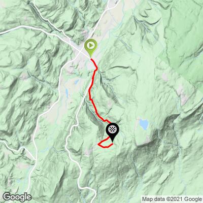
ROUTE MAP
MEMBER RATING
CURRENT WEATHER
PJAMM TRIPS ADVENTURE STARTER BUNDLES
Check out PJAMM Adventure's prepackaged (self-guided) cycling trips. They will help you plan, document and conquer your next adventure.
NEARBY CLIMBS (0) RADIAL PROXIMITY
FROM No Climbs Found
MEMBER REVIEWS & COMMENTS
Let us know what you thought of this climb. Signup for our FREE membership to write a review or post a comment.
Already have an account?
LOG IN HERE
ShlomoZ.11
Gentle way to do 1800ft. Some gravel on the edges