Bwlch Penbarra (SW #88) Bike Climb - PJAMM Cycling

7.8
PDI
1.4 mi
DISTANCE
870 ft
GAINED
11.5 %
AVG. GRADE

FULL CLIMB STATS

INTRO

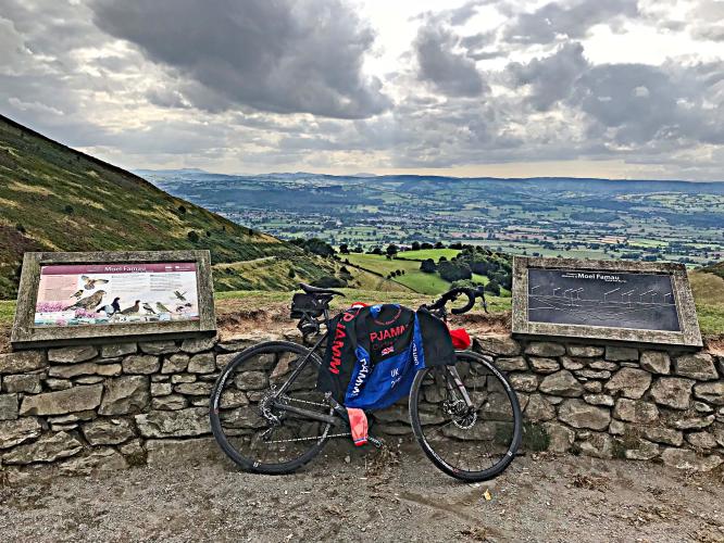
Bwlch Penbarra is a very steep (11.4%) and challenging climb in northern Wales.  Just before the start of the climb is the beautiful Old Saint Peter's church.  As we climb we enter open grazing pastureland. We also noticed that the cloud formations of Britain, at least during August and September when we rode there, are picturesque unto themselves.

Visit our Top UK and also our Top Wales hill climbs pages for photos, summaries and statistics for their respective top hill climbs. 

PLAN YOUR ROUTE

We've partnered with Sherpa-Map.com to bring you the best route planning tool. With a PRO Membership you can use this climb as a reference when creating your route.

See more details and tools regarding this climb's grade via our interactive Profile Tool.
Information Not Available

If you have any information regarding this climb, we'd like to hear from you. Click the CONTRIBUTE button to share your thoughts with us.

Information Not Available

If you have any information regarding this climb, we'd like to hear from you. Click the CONTRIBUTE button to share your thoughts with us.

Before heading out on any cycling adventure check out our Things to Bring on a Cycling Trip and use our interactive check list to ensure you don't forget anything.
Information Not Available

If you have any information regarding this climb, we'd like to hear from you. Click the CONTRIBUTE button to share your thoughts with us.

ROUTE MAP

MEMBER RATING

Not Yet Rated
-
Road
-
Traffic
-
Scenery

CURRENT WEATHER

PJAMM TRIPS ADVENTURE STARTER BUNDLES

Check out PJAMM Adventure's prepackaged (self-guided) cycling trips. They will help you plan, document and conquer your next adventure.
ALL TRIPS
Browse all of our prepackaged trips and find your next adventure!

NEARBY CLIMBS (0) RADIAL PROXIMITY

FROM
No Climbs Found

MEMBER REVIEWS & COMMENTS

Let us know what you thought of this climb. Signup for our FREE membership to write a review or post a comment.
Already have an account?
ROUTE MAP
PROFILE TOOL
Route Data
S.G. (%)
hide
Segment Data
hide
CLIMB SUMMARY

;

Old Saint Peter’s Church just before start of climb

Rolling up to the turn to start the climb we pass the 700+ year old Old St. Peter’s Church, Llanbedr Dyffryn Clwyd (c. 1291).

The road becomes very narrow uponing turning from A494 to Lon Cae Glas where the climb begins.

Climb starts at the intersection of Lon Cae Glas Road and A494.

The 2.3 kilometers of the climb are fairly steady, but at 11.4%!  There is a 200 meter section beginning at 900 meters that averages a punishing 18%.

As we climb we enter open grazing pasture land.  We also have noticed that the cloud formations of Britain, at least during August and September when we rode there, are picturesque unto themselves.

Gate at mile .6

A few sheep along the way.

Typical Britain picturesque cloud formations.

Offa’s Dyke Path hiking trail at the top of the climb.

. The summit is a popular hiking spot it seems. The second half of the climb is exposed and the road it cut into the barron side on the mountain. Pretty steep and difficult climb by welsh standards.


Steepest kilometer begins at 600m (15.6%)

This is quite a challenging climb in northern Wales. A nice article summarizing this challenging climb is found at Spincyclemag.com: