IRONMAN Canada Penticton
Bike Course Recon
Overall Surface Quality:
Average - well paved, but most of course is weathered rural roads
Significant Ascents:
Ironman Penticton is made for the climbers. With almost 2,000 meters of climbing, it’s the 7th hilliest Ironman race in the world. The race also contains the 3rd steepest 10 kilometers out of any bike course in the world.
The course doesn’t contain any PJAMM ranked climbs, but it has four inclines that are seriously flirting with that status:
Climb up from Skaha Lake (@ km 13.3) 4.1km, 120m gained, 11.9% peak gradient
![]()
Climb up from Osoyoos Lake (@ km 63) 10.8km, 402m gained, 11.9% peak gradient
![]()
- Hardest climb on the course
- There’s an aid station halfway through it
Twin Lakes climb (@ km 122.4) 9.2km, 310m gained, 14.7% peak gradient
![]()
- You could argue the climb starts at km 108 (24km of nearly continuous uphill or flat)
There are also 5 other ascents to be noted:
Osoyoos Lake Wall (@ km 58.5)
![]()
- .6 km blip peaking at 8.6%
Crowsnest Hwy Climb (@ km 82)
![]()
- Annoying ~2km long hill breaking up a 12km descent
- Peaks at 7.1%
Hwy 3 Rollers (From km 87 to 95.5)
![]()
- You’ll want to remember these are here. Seven rollers with significant pitches, despite our profile tool rounding them out a bit:
- Roller 1: peaks @ 11.4%
- Roller 2: peaks @ 8.3%
- Roller 3: peaks @ 7.2%
- Roller 4: peaks @ 5.0%
- Roller 5: peaks @ 8.5%
- Roller 6: peaks @ 7.1%
- Roller 7: peaks @ 7.6%
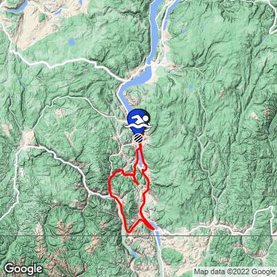
Climb out of the Willowbrook Turnaround (@ km 148.3)
![]()
- You descend this portion before turning around so you’ll get to see what you’re getting into
- Two steep pitches broken up by a ~1km / 21 meter descent section
- Peaks at 11.4%
White Lake/Hwy 97 Intersection Climb (@ km 163.7)
![]()
- Last climb of the bike course
Click here to view a full interactive profile of the 112 mile course.
Turn By Turn
*Turn angle is measured by the sharpest corner angle throughout the entire turn*
Click thumbnail for example (66˚ turn)
![]()
Turn 1:
116˚ left turn; Km 14.3
Entrance gradient (preceding 100 meters): 2.6%
Exit gradient (next 100 meters): 2.6%
![]()
Google Street View
Turn 2:
62˚ right turn; Km 17
Entrance gradient (preceding 100 meters): -2.3%
Exit gradient (next 100 meters): 1.2%
![]()
Google Street View
Turn 3:
60˚ left turn; Km 19.5
Entrance gradient (preceding 100 meters): -2.5%
Exit gradient (next 100 meters): -2.9%
![]()
Google Street View
Turn 4:
77˚ right turn; Km 20.1
Entrance gradient (preceding 100 meters): -2.9%
Exit gradient (next 100 meters): -4%
![]()
Google Street View
Turn 5:
90˚ left turn; Km 22.9
Entrance gradient (preceding 100 meters): 0%
Exit gradient (next 100 meters): 0%
![]()
Google Street View
Turn 6:
118˚ right turn; Km 63.8
Entrance gradient (preceding 100 meters): -0.4%
Exit gradient (next 100 meters): -0.5%
![]()
Google Street View
Turn 7:
Slight right turn; Km 84
Entrance gradient (preceding 100 meters): -7.7%
Exit gradient (next 100 meters): -8.5%
![]()
Google Street View
Turn 8:
75˚ right turn; Km 109.8
Entrance gradient (preceding 100 meters): 2.4%
Exit gradient (next 100 meters): 2.8%
![]()
Google Street View
Turn 9:
90˚ right turn; Km 130.5
Entrance gradient (preceding 100 meters): 0%
Exit gradient (next 100 meters): 2.0%
![]()
Google Street View
Turn 10:
70˚ right turn; Km 132.1
Entrance gradient (preceding 100 meters): -3.7%
Exit gradient (next 100 meters): -5.1%
![]()
Google Street View
Turn 11:
54˚ right turn; Km 132.4
Entrance gradient (preceding 100 meters): 5.3%
Exit gradient (next 100 meters): 6.6%
![]()
Google Street View
Turn 12:
85˚ left turn; Km 134
Entrance gradient (preceding 100 meters): -7.2%
Exit gradient (next 100 meters): -6.9%
![]()
Google Street View
Turn 13:
60˚ left turn; Km 138.4
Entrance gradient (preceding 100 meters): -5.9%
Exit gradient (next 100 meters): -3%
![]()
Google Street View
Turn 14:
100˚ right turn; Km 140
Entrance gradient (preceding 100 meters): -5.3%
Exit gradient (next 100 meters): -2.7%
![]()
Google Street View
Turn 15:
180˚ U-turn; Km 148
Entrance gradient (preceding 100 meters): 0%
Exit gradient (next 100 meters): 0%
![]()
Google Street View
Turn 16:
80˚ right turn; Km 156
Entrance gradient (preceding 100 meters): 2.7%
Exit gradient (next 100 meters): -4.9%
![]()
Google Street View
Turn 17:
80˚ right turn; Km 162.8
Entrance gradient (preceding 100 meters): -6.1%
Exit gradient (next 100 meters): -6%
![]()
No Street Views
Turn 18:
37˚ Left turn; Km 164
Entrance gradient (preceding 100 meters): 12.4%
Exit gradient (next 100 meters): 5.2%
![]()
Google Street View
Turn 19:
90˚ right turn; Km 174.4
Entrance gradient (preceding 100 meters): 0%
Exit gradient (next 100 meters): 0%
![]()
Google Street View
Turn 20:
80˚ right turn; Km 175.1
Entrance gradient (preceding 100 meters): 0%
Exit gradient (next 100 meters): 0%
![]()
Google Street View
Transition Layout:
![]()
Obstacles and Other Notes:
- Due to the amount of climbing/descending, it’s not uncommon to see people choose to ride road bikes with drop bars + clip on aero bars for this triathlon.
Current / Historical Weather Patterns
Full Interactive Bike Course Profile
Link to main race site:
https://www.ironman.com/im-canada?_ga=2.23307258.1525243513.1652043783-1560196912.1650922734
Notice an error, have a suggestion, or an update to this information? Contact us at samlyons@pjammcycling.com!
![]()