
BIKE STATS:
0 mi
DISTANCE
0 ft
PEAK ELEV.
0 ft
ELEV. GAINED
0 %
STEEPEST ¼ mi
FULL COURSE STATS
INTRO
One of the most popular triathlons of all time, the IRONMAN Lake Placid is an iconic race which sells out early every year. The race features a swim in the crystal clear waters of Mirror Lake, a beautiful bike course through the Adirondacks, and a stay in a historic Olympic town. This year Lake Placid is the TriClub North American Championship.
Find and compare other Ironman and 70.3 races on our Triathlon Homepage.
If course information is missing or outdated, please let us know at info@pjammcycling.com
Complete Race Schedule
Parking:
Park at the U.S. Olympic Center, Lake Placid Elementary School, Lake Placid firehouse, Elderwood and Adirondack Health parking lots. Shuttles to transition will be running from each of these locations beginning at 4:30 AM.
Historical Weather:
Summers in upstate New York are usually cool to mild pleasant temperatures, but when it's hot, it's also very humid. Check the PJAMM Cycling Weather Tool for both current and historic weather data.
Local Tri Shops in Lake Placid:
Local public pools in area:
- Lake Placid Olympic Ski Jumping Complex (outdoor)
- Adirondack Health Medical Fitness Center (indoor)
Open water swim areas in area:
- Mirror Lake Public Beach** (race venue)
Information Not Available
If you have any information regarding this triathlon, we'd like to hear from you. Click the CONTRIBUTE button to share your thoughts with us.
There isn't enough space here to cover all the amazing things there are for you and your family to do in Lake Placid. This small ski town in put itself on the map in 1980 and isn't going anywhere.
Just down the street is perhaps our favorite climb in all of the Northeast, Whiteface Mountain. If you're traveling to do this race, you cannot miss riding this one!
Good Hotels:
- Cadence Lodge (we stay here every time we can-one of our all time favorites!)
Good Restaurants
Good Brews (☕ï¸+ðŸº)
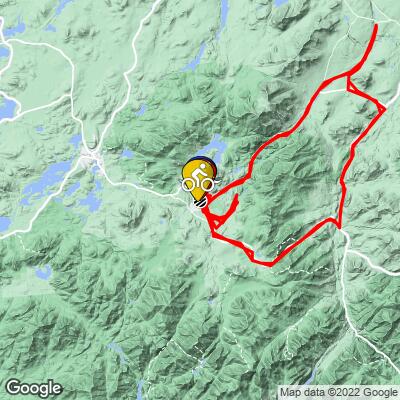
COURSE MAP
CURRENT WEATHER
PJAMM TRIPS ADVENTURE STARTER BUNDLES
Check out PJAMM Adventure's prepackaged (self-guided) cycling trips. They will help you plan, document and conquer your next adventure.
NEARBY BIKE CLIMBS (0) RADIAL PROXIMITY
FROM No Climbs Found
MEMBER COMMENTS
Let us know your thoughts about this triathlon. Signup for our FREE membership to post a comment or question.
Already have an account?
LOG IN HERE


