
BIKE STATS:
0 mi
DISTANCE
0 ft
PEAK ELEV.
0 ft
ELEV. GAINED
0 %
STEEPEST ¼ mi
FULL COURSE STATS
INTRO
Ironman Tulsa has quickly became one of the favorite triathlons in America. Beginning in just 2021, the hilly but fast course has captured the hearts of age-groupers and attracted the likes of world class pros such as 5-time world champion and Kona course record holder Daniela Ryf, 2017 and 2018 world-champion Patrick Lange, USA Olympian Andy Potts, and 2018 Kona runner up Bart Aernouts. Its central location makes it an ideal race destination for athletes all over the country.
If course information is missing or outdated, please let us know at info@pjammcycling.com
Full Event Schedule
Parking:
You will park at the Oklahoma State University Tulsa campus Lot A and a mandatory athlete shuttle will take you to Keystone Lake. Shuttles will run from 4am to 5:45am. Spectators will be allowed on the shuttles after 5am, there will be no parking at the lake/T1.
Historical Weather:
Tulsa in late May can either be very nice or very hot. May and June are the most humid months of the year. Check the PJAMM Cycling Weather Tool for current and historic weather data.
Local Tri Shops:
Local Public Pools:
(non-members are allowed one free visit to YWCA facilities)
Popular open water swim areas:
- Keystone Lake Boat Ramp** (race venue)
No swimming in Shell Lake (used for city water)
Information Not Available
If you have any information regarding this triathlon, we'd like to hear from you. Click the CONTRIBUTE button to share your thoughts with us.
There are lots of places to stay in Tulsa. Here are our pics:
For convenience:
For the Tulsa Experience:
Oklahoma BBQ is a must-try. Appropriately, its a perfect mix of Kansas City Style (ribs and thick sweet sauces -think Sweet Baby Rays) and Texas Style (beef!). Below are our favorites.
Good Restaurants:
It's 1 hour south, but if you're driving up I-44 to get to the race, The Butcher BBQ Stand is our all-time favorite in the state.
Good Brews (☕ï¸+ðŸº):
Good Brews (☕ï¸+ðŸº):
☕ï¸
☕ï¸
ðŸ»
ðŸ»
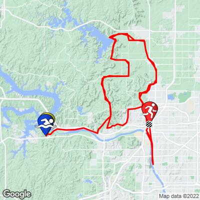
COURSE MAP
CURRENT WEATHER
PJAMM TRIPS ADVENTURE STARTER BUNDLES
Check out PJAMM Adventure's prepackaged (self-guided) cycling trips. They will help you plan, document and conquer your next adventure.
NEARBY BIKE CLIMBS (0) RADIAL PROXIMITY
FROM No Climbs Found
MEMBER COMMENTS
Let us know your thoughts about this triathlon. Signup for our FREE membership to post a comment or question.
Already have an account?
LOG IN HERE


