
BIKE STATS:
0 mi
DISTANCE
0 ft
PEAK ELEV.
0 ft
ELEV. GAINED
0 %
STEEPEST ¼ mi
FULL COURSE STATS
INTRO
IRONMAN Mont Tremblant is a full distance triathlon located in Mont-Tremblant, Canada. The swim is 3.8 km, bike is 180 km, and the run is 42 km. Use the profile tool, route maps, weather forecast, and other tools on this page to more efficiently and effectively train for your race.
Find and compare other Ironman and 70.3 races on our Triathlon Homepage.
If course information is missing or outdated, please let us know at info@pjammcycling.com
Full Event Schedule
Parking:
There are multiple large parking lots in Mont Tremblant, such as P2 which should be available on race day.
Historical Weather:
Southern Quebec in the summer tends to be very humid and incredibly buggy. Check the PJAMM Cycling Weather Tool for current and historic weather data, and don't forget your sunscreen and bug spray.
Local Tri Shops:
Local Public Pools:
Popular open water swim areas:
Information Not Available
If you have any information regarding this triathlon, we'd like to hear from you. Click the CONTRIBUTE button to share your thoughts with us.
Most Loved Hotels:
Best Brews (☕ï¸+ðŸº):
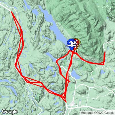
COURSE MAP
CURRENT WEATHER
PJAMM TRIPS ADVENTURE STARTER BUNDLES
Check out PJAMM Adventure's prepackaged (self-guided) cycling trips. They will help you plan, document and conquer your next adventure.
NEARBY BIKE CLIMBS (0) RADIAL PROXIMITY
FROM No Climbs Found
MEMBER COMMENTS
Let us know your thoughts about this triathlon. Signup for our FREE membership to post a comment or question.
Already have an account?
LOG IN HERE


