![]()
Cycling Hetch Hetchy, Yosemite National Park
Ride 6 miles gaining 1,332’ to elevation 5,126’ at 4.1% average grade.
![]()
Hetch Hetchy Road on the way to the reservoir.
Visit our Yosemite National Park page for more rides in Yosemite.
This is a fairly mild climb in Northwestern Yosemite National Park. The climb begins at the O'Shaughnessy Dam and ends a few miles north of the park’s only entrance that does not access Yosemite Valley -- the road dead ends at the dam. The steepest mile is just under 5% average grade so this road bike climb is more for the beauty of the Hetch Hetchy area than it’s difficulty.
![]()
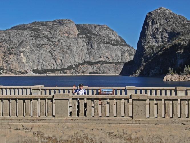
View of John on the dam with Hetch Hetchy Reservoir in the background.
![]()
O'Shaughnessy Dam was constructed in 1934.
![]()
The climb begins at Hetch Hetchy Reservoir
We climb from the dam south, away and up from the dam.
![]()
Rustic scenes on the way to the climb.
![]()
This is the northernmost entrance to the park.
This is a dead end -- you cannot access the full park on this road.
![]()
It’s about 7½ miles to the dam from the Ranger Kiosk.
![]()
No fee to enter as of October 2019.
![]()
Just past the ranger station.
![]()
![]()
Start at (not on) the dam.
![]()
![]()
Just past the start of the climb -- riding up the road from the reservoir.
![]()
View from the road about a mile up from the dam.
![]()
View about halfway up the climb.
A LITTLE HISTORY
![]()
Hetch Hetchy Valley was revered as a scenic equivalent to Yosemite Valley before the dam was built.
Photo: sfchronicle.com
San Francisco began efforts to dam the Tuolumne River at the western end of the Hetch Hetchy Valley in the early 19th Century. Of course, the project was opposed by environmentalists and naturalists who respected and appreciated the delicate beauty of this unique and spectacular area.
![]()
June 25, 1913 SF Chronicle article.
Notice the article references John Muir, calling him “chief of the nature lovers.”
Photo: sfchronicle.com
The 1906 earthquake and fire exposed San Francisco’s inadequate water supply and led to efforts to tap the Tuolumne River as the primary water source for that city. This led to a seven-year environmental battle with John Muir and the Sierra Club. In 1913 Congress passed the Raker Act which permitted a dam to be constructed in Yosemite National Park’s Hetch Hetchy Valley. Construction of the dam began in 1914 and was completed 20 years later in 1934. Hetch Hetchy Reservoir provides water for 80% of the City and County of San Francisco.
![]()
Moccasin is a company town owned almost entirely by the City and County of San Francisco.
![]()
![]()
Moccasin is occupied by employees who work for the Hetch Hetchy Water & Power System.
![]()
Yosemite National Park
![]()
Photo, from upper left clockwise:
El Capitan; Western Entrance; Tioga Pass; Hetch Hetchy Dam; Glacier Point (middle).
![]()
That’s a wrap!

 We've partnered with Sherpa-Map.com to bring you the best route planning tool. With a PRO Membership you can use this climb as a reference when creating your route.

