![Cycling Tioga Pass, Yosemite Cycling Tioga Pass, Yosemite - panoramic view of Tioga Pass, Sierra Nevadas]()
Cycling Tioga Pass, Yosemite: One of the greatest bike climbs in the Sierra Nevada Mountain Range
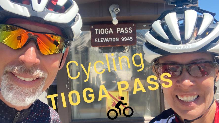
Ride 12 miles to 9,945’ gaining 3,272’ at 4.9% average grade.
Visit our Cycling Yosemite National Park page. This is a US Top 10 Most Epic Bike Climb.
Climb summary by PJAMM’s John Johnson.
Before heading out on your Yosemite-area cycling adventure, be sure to rely on our list of Things to Bring on a Cycling Trip, and use our interactive checklist to ensure you don't forget anything.
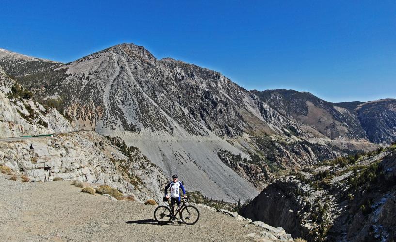
"Tioga" is named for an Iroquois and Mohawk term meaning "where it forks." The most spectacular part of Tioga Pass may be the sheer drop off that is dramatically obvious when you look back at the viewpoint (see Google Streetview, below) at mile 8.3.
![Cycling Tioga Pass, Yosemite photo collage, PJAMM cyclist stands at summit of Tioga Pass, PJAMM cyclist rides on Tioga Pass with mountains behind him and wildflowers in front, aerial drone view of roadway carved into mountain side, sign for Inyo National Forest]()
Cycling on Tioga Road (Highway 120).
Tioga Pass is the beginning of the 75 mile journey from Highway 395 westbound into Yosemite Valley. It is one of four routes, or Gateways into Yosemite (the other three being Highway 120/Groveland from the north, 49/140/Mariposa from west, and Highway 41/Oakhurst from the south).
The eastern Park (Eastern Gateway) entrance is right at Tioga Pass at almost precisely the 12 mile mark of the climb. The crux of the climb begins at mile four and the next five miles average 7.4% compared to the 4.6% average for the full climb.
![Tioga Pass - Start Cycling Tioga Pass - beginning of climb - cyclist on bike with roadway sign; hwy 120 sign]()
The climb is on Highway 120 to the park entrance.
![Tioga Pass - Start Cyclist on road, Mono Lake in background]()
Mono Lake is in your rearview mirror as you begin the climb.
![Tioga Pass - Start Sign for Inyo National Forest]()
Climb is in Inyo National Forest (1,903,381 acres; est. 1907).
![Tioga Pass - Start Aerial drone view of cyclist on two-lane roadway climbing up Tioga Pass]()
![Tioga Pass Aerial drone view shows amazing rock formations on Tioga Pass]()
The amazing rock formations . . . and . . .
![]()
. . . sheer cliffs along the climb make this an epic cycling adventure . . .
![Tioga Pass PJAMM Cyclist stands with bike on mountainside, Tioga Pass, amazing rock formations]()
. . . with some amazing photo opportunities!
![Tioga Pass - Epic Stretch cycling Tioga Pass - cyclist passing flowers, roadway and mountains]()
Awesome! 9,000’ . . .
. . . .Hey! You still have 945’ to go!!
![Tioga Pass Looking down on Tioga Lake]()
Tioga Lake - One mile from the park entrance and finish.
![Cycling Tioga Pass PJAMM Cyclist stands with bike near ticket booth at Yosemite National Park entrance]()
Enter the park just past finish of climb.
![Cycling Tioga Pass Tioga Pass sunrise]()
And the #1 reason to start your climb early . . .
We recommend beginning this climb in the early morning to avoid the Yosemite Valley-bound traffic which always includes some, if not many, RV’s and trailers, which may include rentals driven by tourists inexperienced with such a vehicle.
Food/Fluids: There is nothing along the first 12 miles of the route, but food/fluids are available, if you are continuing on towards Yosemite Valley, at Tuolumne Meadows Grill and the Tuolumne Meadows Store (mile 19.3) and Crane Flat Gas Station (mile 58.6).
![]()
That’s a wrap!!
CYCLING YOSEMITE
PJAMM’s Yosemite NP Climb Page
![Yosemite Valley Aerial drone photo Yosemite Valley]()
Yosemite Valley - El Capitan + Half Dome
![Cycling Tioga Pass, Yosemite Photo collage; El Capitan; Western Entrance; Tioga Pass; Hetch Hetchy Dam; Glacier Point (middle)]()
Photos clockwise from upper left:
El Capitan; Western Entrance; Tioga Pass; Hetch Hetchy Dam; Glacier Point (middle)
Viewpoints between Lee Vining and Yosemite Valley: This route includes so much of what Yosemite has to offer: Tioga Pass (beginning of ride), Lembert Dome (mile 18.5), Tuolumne Meadows (miles 19-20).
![Cycling Tioga Pass, Yosemite Lembert Dome]()
Lembert Dome.
![Cycling Tioga Pass, Yosemite Tolumne Meadows]()
Tuolumne Meadows.
Tenaya Lake (miles 26.5 to 27.5), Olmstead point (mile 29.2 - views of Half Dome and a great viewpoint on the way back into the valley, which is one of the few points where you have excellent views of both El Capitan and Half Dome).
![Cycling Tioga Pass, Yosemite Tenaya Lake]()
Tenaya Lake
![Cycling Tioga Pass, Yosemite Olmstead Point]()
Olmstead Point.
![Cycling Tioga Pass, Yosemite El Capitan and Half Dome as seen on the way down towards Yosemite Valley]()
El Cap and Half Dome on the way down to Yosemite Valley.
Fee to enter the park: As of June, 2015, the fee to enter the park on a bicycle was $15. We purchased the $80 All-Parks Pass which gives us access for the year into all National Parks.
Roadway Surface and Traffic Report: The roadway is excellent throughout, but the road is narrow and there are many wide vehicles on the road after the early morning hours, although this route is closed to commercial vehicles.

 We've partnered with Sherpa-Map.com to bring you the best route planning tool. With a PRO Membership you can use this climb as a reference when creating your route.


