![]()
Cycling Sand Creek Road to Highways 245-180-198 (ending at Big Baldy Trailhead Hwy 198)
Ride 28 miles gaining 5,830’ at 3.7% average grade.
The Sand Creek Road-Highway 245-180-198 cycling climb is the third longest bike climb in California (behind Onyx Summit 30.4 miles and Hwy 25-245-180-198 28.4 miles). This #56 Top US bicycle climb travels into both the Sequoia National Forest and Kings Canyon National Park and is within 30 miles of 2 Top 100 US climbs, Mineral King Rd (#18) and Hwy 198 (#26).
![]()
Lower section of the climb during in the springtime.
![IMG_1441.JPG]()
Enter Sequoia National Forest (1,193,315 acres; est. 1908) at mile 11
![IMG_1455.JPG]()
Enter Kings Canyon National Park (404,064 acres; est. 1890) at mile 19
$15 for cyclist as of 2019 . . . . unless . . .
![]()
You are “lucky” enough to be 62 (or older 😐)
$80 for lifetime pass as of 2019.
![IMG_1455.JPG]()
28 miles later we finish here.
What do you get with this climb?
![]()
Rustic scenes on our way from Orange Cove.
Photo: Allen Ibara
![]()
General Grant Tree
Named in 1867 after General and President Grant.
Photo: Allen Ibara
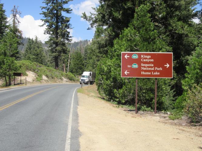
The General Grant Tree was believed to be the world’s largest tree until General Sherman Tree discovered in 1931. To get to this tree, turn left to stay onto Hwy 180 at its junction with Hwy 198 (mile 21) instead of turning right onto 198.
GENERAL SHERMAN TREE
LARGEST TREE BY VOLUME IN THE WORLD
Travel 20 miles past the finish of our climb (ascend 1,755’, descend 2,427’ at -.07% average grade). At 275’ tall, with a 102.6’ circumference and a 35.5’ diameter, the General Sherman is the largest single-stem tree on Earth. The tree is named for famed Union General William Tecumseh Sherman.
![IMG_1650.JPG]()
The entrance for this extraordinary experience is near the end of the climb.
![IMG_3208.JPG]()

 We've partnered with Sherpa-Map.com to bring you the best route planning tool. With a PRO Membership you can use this climb as a reference when creating your route.

