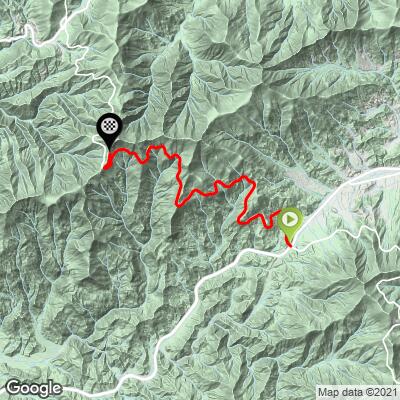
13.5
PDI
8.6 mi
DISTANCE
2,462 ft
GAINED
5.5 %
AVG. GRADE
FULL CLIMB STATS
Page Contributor(s): John Summerson’s The Complete Guide to Climbing (by bike) in the Southeast, p. 98
INTRO
Cycle the entire Blue Ridge Parkway – see PJAMM’s March 2022, 467-mile adventure on the PJAMM Adventures App: Blue Ridge Parkway. See also our Climbs of the BRP (NC to VA) and Climbs of the BRP (VA to NC).
PLAN YOUR ROUTE
See more details and tools regarding this climb's grade via our interactive Profile Tool.
Information Not Available
If you have any information regarding this climb, we'd like to hear from you. Click the CONTRIBUTE button to share your thoughts with us.
Information Not Available
If you have any information regarding this climb, we'd like to hear from you. Click the CONTRIBUTE button to share your thoughts with us.
Before heading out on any cycling adventure check out our Things to Bring on a Cycling Trip and use our interactive check list to ensure you don't forget anything.
ROUTE MAP
MEMBER RATING
CURRENT WEATHER
PJAMM TRIPS ADVENTURE STARTER BUNDLES
Check out PJAMM Adventure's prepackaged (self-guided) cycling trips. They will help you plan, document and conquer your next adventure.
NEARBY CLIMBS (0) RADIAL PROXIMITY
FROM No Climbs Found
MEMBER REVIEWS & COMMENTS
Let us know what you thought of this climb. Signup for our FREE membership to write a review or post a comment.
Already have an account?
LOG IN HERE
TMead

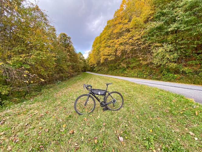
Average 3-5 cars passing on summer weekdays during entire morning climb so very little traffic weekdays. Nearly always foggy before 10am. Can be 10-15 degrees colder at top and usually windy. Plenty of overlooks to rest if needed. Small store at Waterrock knob rest area.
jsummers
A very nice climb over steady grade. Scenery is the king on this one but it is a good workout as well, easing towards the top. Stay away on weekends unless you don't mind traffic (can be relentless) and it is a nice, sweeping descent.