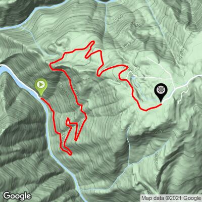
The Corkscrew Bike Climb - PJAMM Cycling

6.6
FIETS
4.4 mi
DISTANCE
2,270 ft
GAINED
9.6 %
AVG. GRADE

FULL CLIMB STATS

Page Contributor(s): Cal Erdman, Sacramento, CA, USA; Dan Razum, Campbell, CA, USA; John Berude, Berkely, CA, USA

INTRO

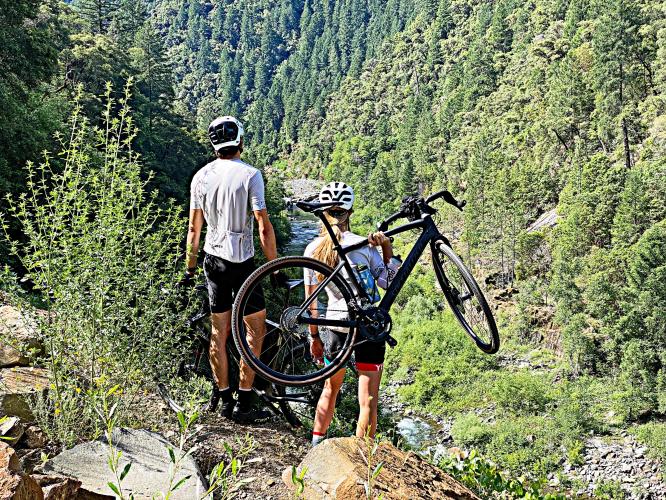
The Corkscrew is a short but stout climb off Mosquito Ridge Road and can (should?) be done in conjunction with some derivation of the Mosquito Ridge climb (see spreadsheet below). This is a remote climb in the Tahoe National Forest. Take Fire Road 23 off of Mosquito Ridge Road and travel 2.3 miles to the Oxbow Reservoir and Rubicon River. Just past the Reservoir the climb begins in earnest.  Note that a slide blocked part of the road as of 2020 - see Full Summary for more details. 
10.1% average grade (10.8% climb only).   41% of the climb is at 5-10% grade, 21% is at 10-15%, 23% is at 15-20%, and 1% is at ≥20%. The steepest quarter-mile is 17.2%. 

Use the “Routes in Area” button on the menu bar to see other bike climbs in this area. 
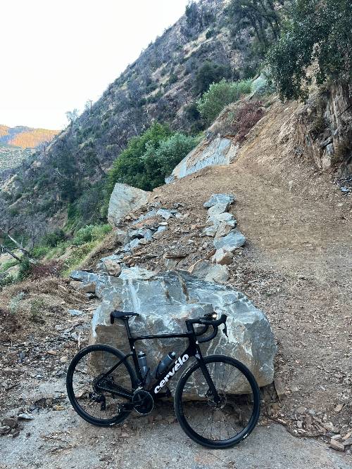
Roadway:  Narrow two lane roadway in decent to marginal condition.  The road is currently blocked by a slide, navigable on foot by only the bravest of soles . . . See Full Summary for more details. 

Traffic:  Minimal to none. 

Parking:  At the start of the climb - Map.
Provisions:  None on or near the climb.  The closest food and beverages are found in Forest Hill 13 miles north (Map). 
Before heading out on any cycling adventure check out our Things to Bring on a Cycling Trip and use our interactive check list to ensure you don't forget anything.
This is a very fun climb if they clear the road, or you go for it by walking over the slide area.  Also consider doing Mosquito Ridge which is very close to this climb as well as the spooky Interbay Road.  Use the “Routes in Area” button on the menu bar to see other bike climbs in this area.

ROUTE MAP

MEMBER RATING

Difficulty: Strenuous
4
Road
5
Traffic
4
Scenery

CURRENT WEATHER

PJAMM TRIPS ADVENTURE STARTER BUNDLES

Check out PJAMM Adventure's prepackaged (self-guided) cycling trips. They will help you plan, document and conquer your next adventure.
ALL TRIPS
Browse all of our prepackaged trips and find your next adventure!
Lake Tahoe
United States (CA,NV)
18 ROUTES
32 POIs
ROUTE STATS (TOTAL)
245.7
mi
DISTANCE
35,240
ft
ELEV. GAIN

NEARBY CLIMBS (0) RADIAL PROXIMITY

FROM
No Climbs Found

MEMBER REVIEWS & COMMENTS

Let us know what you thought of this climb. Signup for our FREE membership to write a review or post a comment.
Already have an account?

Jun 1, 2021
difficulty: Strenuous
scenery: 4
traffic: 5
road: 4
Jun 1, 2021
scenery: 4
traffic: 5
road: 4
First off, yes, the landslide has blocked it and PG&E has no plans to ever clear it. That being said, enough people do this that the hike a bike route over the debris is pretty well established. Ride past the hydro plant to the debris and then go to the high side. About 30 yds above there is a path most people take to get around. It will take you about 10 minutes with bike shoes on and then you are home free! This is a great climb and doing it as a loop up to French Meadows and then down Mosquito Ridge road is an epic day! Do it but be sure to bring water. I usually stash and extra bottle at the bridge at the bottom of Mosquito Ridge.
ROUTE MAP
PROFILE TOOL
Route Data
S.G. (%)
hide
Segment Data
hide

Climb Profile Not Found
CLIMB SUMMARY

Cycling the Corkscrew . . . if you dare . . . .

In 2018,  our friend from Campbell CA, Dan Razum reported of Corkscrew:

“I checked out The Corkscrew ride in July 2019 and it is well and true closed from the landslide.  I took some pictures of the slide, I can send to you if you want.  I don't think the climb will ever open again, it is a major slide and the road is so remote that it will probably never be cleared.  It is totally unpassable, can't even be hiked, there is a lot of scree.”

Left photo - road can barely be seen.

. . . but, WAIT . . . then there is adventurer extraordinaire John Berude, Berkeley, CA:

Note:  If you do not want to John Berude It,  you can access the climb by doing Mosquito Ridge climb (Map of just the Mosquito Ridge climb) then continuing on Mosquito Ridge to French Meadows Road (turning right there) at mile 25.5 then bending right to merge onto French Meadows Road at mile 30.9 until you get to the back slide of the slide and the bottom of the Corkscrew climb - then turn around and retrace your steps to the start of the Mosquito Ridge climb - here’s the out-and-back map for this 96.5 mile 12,880’ day - https://ridewithgps.com/routes/26178601 

Here’s what you get if you go for it . . .

From John Berude:

The Corkscrew is a lovely, remote climb in the Tahoe National Forest that accesses the network of higher elevation paved and gravel roads between US-50 and I-80. The climb and following ridgetop is almost guaranteed to be car-free for at least 18 miles (except for the odd hydro worker or logging truck) thanks to a major landslide at the start of the climb. Crossing the landslide is a commitment, but well worth the effort. The dirt and rock is steep but pretty solid, and there are faint trails you can follow. Mountain cleats only... don't even think about attempting this in road shoes! When I did the crossing, we chose a higher traverse line than we initially thought we should and it made for much easier travel than the lower lines.

Once you're on the other side of the landslide, it is a blissful climb with excellent views into the canyon. The bulk of the climb is all-but-forgotten, though the pavement remains in good shape. Once at the top, you can continue along an equally excellent ridgeline to the junctions with Eleven Pines Rd or French Meadows/Hell Hole Rd. If you brought a road bike, go check out the reservoirs and finish your ride with the world-class 17 mile descent of Mosquito Ridge Rd! If you brought a gravel bike (which you should), then go get lost in the folly of the forest on the wonderful gravel roads beyond the reservoirs... and then rip the epic Mosquito Ridge Rd descent!

Oxbow Reservoir on the Rubicon River.  

There are some great views of the Hydroelectric Plant (the start) about 1,000’ up the climb as well as some interesting “look-backs” at the Corkscrew you just navigated.  The grade on this beast is steep throughout, spiking at the mid to upper-teens in spots.  This one will test you!

 20151107_113317.jpg

This one qualifies as epic.

John Berude and JJ atop Mt. St. Helena after John’s KOM.

Access to full Climb Summary requires a PJAMM Cycling PRO Membership!

It takes less than a minute to sign up & with your PRO membership you can:
  • Rate climbs, post comments and share your experiences on any of our climb pages
  • Create bucket lists of climbs & mark the dates you complete them
  • Weather data for all climbs - Start & Finish
  • Upload photos to your member page to customize your PJAMM Cycling experience
  • Utilize all of our interactive tools - Profile & Routes in Area
  • Download climb route .gpx files
LEARN MORE
SIGN UP

Already have an account? LOG IN HERE