INTRO
PLAN YOUR ROUTE
 We've partnered with Sherpa-Map.com to bring you the best route planning tool. With a PRO Membership you can use this climb as a reference when creating your route.
 ROUTE MAP


 We've partnered with Sherpa-Map.com to bring you the best route planning tool. With a PRO Membership you can use this climb as a reference when creating your route.
Cycling Sierra Road, the steepest bike climb in the San Jose area.
Ride 3.7 miles to 2,037’ gaining 1,841’ at 9.5% average grade.
Aerial drone photo of Sierra Road (seen right-center) and Calaveras Reservoir (seen upper left).
Climb summary by PJAMM’s John Johnson.
Sierra Road is a beast -- it’s one of the steepest climbs in Santa Clara County. The climb hits you right at the start at 10.2% for the first half mile to the sharp left hand turn.
Climb start.
Looking down at the first ¼ miles @ 12%.
Yes, this climb is “fowl” -- I did slow for the turkey crossing however . . .
A lot of scenic pasture and grazing livestock on Sierra Road.
This is the last of three major climb segments of the popular but brutal Devil Mountain Double, hitting you at mile 160 of that ride -- ouch! There are excellent views of the Silicon Valley to the west as we ascend and there is a nice open-space lookout view area at the top.
Just finishing the steepest ½ mile segment.
Photo at mile 1.8 - steepest ½ mile segment begins mile 1.3.
Roadway Surface and Traffic: The roadway is in excellent condition and there is very little traffic on the roadway as it enters open space area around mile 1.5.
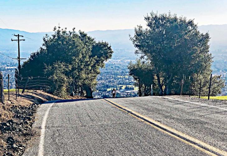
Just completing steepest segment - San Jose in background (¼ mile @ 13.4%).
Wide open space on the second half of the climb.
Last quarter mile to the top -- San Jose in background.
Hiking trail at the finish.
Sierra Open Space Preserve parking lot and sign at top of climb.
Mt. Hamilton’s Lick Observatory -- background left of sign.
AMGEN TOUR OF CALIFORNIA
Sierra Road was the most consistently-included climb during the early years of the Tour of California, having been included five straight years from 2007 through 2011. However, the Tour has not returned to this difficult though brief climb since 2011.
Mountain-top finish 2011.
That’s a wrap!