11.7
PDI
4.6 mi
DISTANCE
1,820 ft
GAINED
7.3 %
AVG. GRADE
FULL CLIMB STATS
INTRO
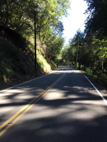
Black Road is one of 4 great climbs in the Lexington Reservoir area. Not much for distant views, this is a challenging climb that begins at the intersection of Black and Montevina Roads and climbs on up to Skyline Blvd (Hwy 35). We are surrounded and covered by a canopy of tree branches throughout the climb which is a popular route for local cyclists. Towards the top (at the steepest segment of the climb) we run through a series of 10 sharp switchbacks which are quite fun on the descent.
PLAN YOUR ROUTE
See more details and tools regarding this climb's grade via our interactive Profile Tool.
Information Not Available
If you have any information regarding this climb, we'd like to hear from you. Click the CONTRIBUTE button to share your thoughts with us.
Information Not Available
If you have any information regarding this climb, we'd like to hear from you. Click the CONTRIBUTE button to share your thoughts with us.
Before heading out on any cycling adventure check out our Things to Bring on a Cycling Trip and use our interactive check list to ensure you don't forget anything.
Information Not Available
If you have any information regarding this climb, we'd like to hear from you. Click the CONTRIBUTE button to share your thoughts with us.
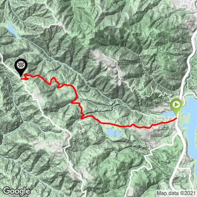
ROUTE MAP
MEMBER RATING
CURRENT WEATHER
PJAMM TRIPS ADVENTURE STARTER BUNDLES
Check out PJAMM Adventure's prepackaged (self-guided) cycling trips. They will help you plan, document and conquer your next adventure.
NEARBY CLIMBS (0) RADIAL PROXIMITY
FROM No Climbs Found
MEMBER REVIEWS & COMMENTS
Let us know what you thought of this climb. Signup for our FREE membership to write a review or post a comment.
Already have an account?
LOG IN HERE