12
PDI
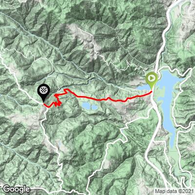
3.2 mi
DISTANCE
1,566 ft
GAINED
9.4 %
AVG. GRADE
FULL CLIMB STATS
INTRO
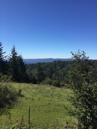
The Black-Gist Road Route is a short but deadly climb that begins across Hwy 17 from the Lexington Reservoir. The first 1.8 miles to the fork at Gist and Black Roads is 1.8 miles at 8.5% and the remaining 1.3 miles to the top of Gist and its intersection with Skyline Blvd (Hwy 35) is 10%. We are surrounded and covered by trees almost the entire climb.
PLAN YOUR ROUTE
See more details and tools regarding this climb's grade via our interactive Profile Tool.
Information Not Available
If you have any information regarding this climb, we'd like to hear from you. Click the CONTRIBUTE button to share your thoughts with us.
Information Not Available
If you have any information regarding this climb, we'd like to hear from you. Click the CONTRIBUTE button to share your thoughts with us.
Before heading out on any cycling adventure check out our Things to Bring on a Cycling Trip and use our interactive check list to ensure you don't forget anything.
Information Not Available
If you have any information regarding this climb, we'd like to hear from you. Click the CONTRIBUTE button to share your thoughts with us.
ROUTE MAP
MEMBER RATING
CURRENT WEATHER
PJAMM TRIPS ADVENTURE STARTER BUNDLES
Check out PJAMM Adventure's prepackaged (self-guided) cycling trips. They will help you plan, document and conquer your next adventure.
NEARBY CLIMBS (0) RADIAL PROXIMITY
FROM No Climbs Found
MEMBER REVIEWS & COMMENTS
Let us know what you thought of this climb. Signup for our FREE membership to write a review or post a comment.
Already have an account?
LOG IN HERE
veerravuri
Done this once, it is a fun climb and there is a flat section in the middle where you can refill water at the school. Gist is a wild descent though as it's all hairpins so be careful descending that. It is steep of course but gist is relatively short.