8.3
PDI
7 mi
DISTANCE
1,802 ft
GAINED
4.1 %
AVG. GRADE
FULL CLIMB STATS
INTRO
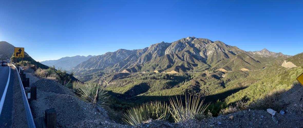
Lower Big Tujunga Road winds through a beautiful desert canyon, climbing roughly 1800 feet. For the official PJAMM climb, we include the right turn on Angeles Forest Highway to the Clear Creek intersection because it is more than worth doing, and to include the stunning overlooks west back over the climb you just rode. As well as being an incredibly scenic climb, this is a great A to B ride as well, taking you right to iconic LA area climbs like Mt. Wilson, Mt. Gleason, or Upper Big Tujunga Canyon Road.
PLAN YOUR ROUTE
See more details and tools regarding this climb's grade via our interactive Profile Tool.
Roadway:
Excellent; paved recently (in early 2023)
Parking:
You can start your ride through the Los Angles National Forest anywhere by parking along the side of the road at a pulloff, trailhead or scenic view. Most of these places you need to buy a daily adventure pass, but an America the Beautiful national park pass will also work.
You can also find places to park for free just outside of the NF, like at local parks such as Oro Vista Park at the entrance of Big Tujunga Canyon.
Traffic:
Generally very light. Our route for this climb turns right and ends at Clear Creek intersection, and traffic may be a bit heavier on the Angeles Forest Highway after this turn.
Do NOT ride north in the mid to late afternoon on Angeles Crest Hwy or Angeles Forest Hwy - traffic is very heavy to Palmdale.
Information Not Available
If you have any information regarding this climb, we'd like to hear from you. Click the CONTRIBUTE button to share your thoughts with us.
Before heading out on any cycling adventure check out our Things to Bring on a Cycling Trip and use our interactive check list to ensure you don't forget anything.
The San Gabriel Mountains of Los Angeles are a 365 day of the year cycling paradise. Check out our pre-planned adventure for the best routes, loops and rides.
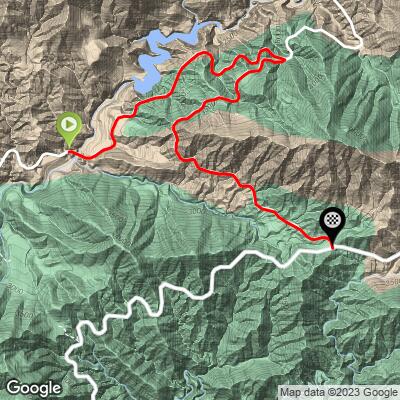
ROUTE MAP
MEMBER RATING
CURRENT WEATHER
PJAMM TRIPS ADVENTURE STARTER BUNDLES
Check out PJAMM Adventure's prepackaged (self-guided) cycling trips. They will help you plan, document and conquer your next adventure.
NEARBY CLIMBS (0) RADIAL PROXIMITY
FROM No Climbs Found
MEMBER REVIEWS & COMMENTS
Let us know what you thought of this climb. Signup for our FREE membership to write a review or post a comment.
Already have an account?
LOG IN HERE