20.5
PDI
16.1 mi
DISTANCE
3,659 ft
GAINED
4.1 %
AVG. GRADE
FULL CLIMB STATS
Page Contributor(s): Christopher Jacobs, Byers, CO, USA; Todd Short, Scottsdale, AZ, USA; Eric Kuehl, Chicago, IL, USA.
INTRO
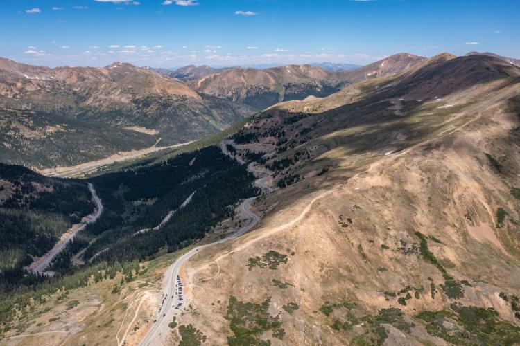
This is a fantastic bike climb in part because, like Vail Pass East and Vail Pass West, the majority of it is along a bike path. This climb reminds us of the dedicated bike path on France’s most difficult bike climb, Col de la Loze (Meribel).
PLAN YOUR ROUTE
The climb averages 4% (4.9% if descent is removed). 44% (7 miles) is at 0-5% grade, and 43% (6.9 miles) is at 5-10%. The steepest quarter-mile is 9.1% and steepest mile 7.1%.
See more details and tools regarding this climb's grade via the “Profile Tool” button.
Roadway: The first 1.3 miles are on a two lane roadway leaving Georgetown towards the Georgetown Loop Railroad. After passing through two hairpins and past the Loop Railway, we enter a bike lane which goes for 10.7 miles without motor vehicles. The final four miles are on Highway 6 which is a two lane highway in excellent condition
Traffic: Not an issue for the first 12 miles. Traffic is mild for our four miles up Highway 6.
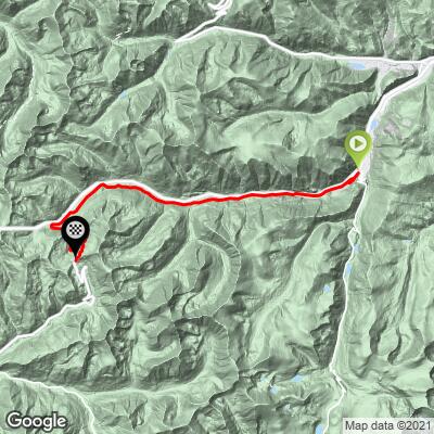
Parking: On a pullout one-third of a mile up the road from the start of the climb: Map; Street View, or at public parking in Georgetown on Taos Street - Map; Street View.
Provisions: Not much after leaving Georgetown - in an emergency there may be a bar in Cherokee Creek at mile 2.2, or the ski resort may be open at mile 12.3 but don't count on either.
Weather and Gear: Since you are finishing near 12,000', be sure to consult the PJAMM "Full Forecast" feature for the time you expect to arrive at the finish to assess what clothing to bring on your ride.
Before heading out on any cycling adventure check out our Things to Bring on a Cycling Trip and use our interactive check list to ensure you don't forget anything.
Lodging: Georgetown is a charming town preserved from its 19th century gold rush beginnings - it would be fun to stay in this town when cycling Guanella Pass and Loveland Pass.
Be sure to consider cycling Guanella Pass because it is an epic bike climb, ranked #106 in the US. You may also consider an out and back for Loveland from Georgetown and Loveland Pass from Keystone - 48 miles gaining 6,280' (Map).
ROUTE MAP
MEMBER RATING
CURRENT WEATHER
PJAMM TRIPS ADVENTURE STARTER BUNDLES
Check out PJAMM Adventure's prepackaged (self-guided) cycling trips. They will help you plan, document and conquer your next adventure.
NEARBY CLIMBS (0) RADIAL PROXIMITY
FROM No Climbs Found
MEMBER REVIEWS & COMMENTS
Let us know what you thought of this climb. Signup for our FREE membership to write a review or post a comment.
Already have an account?
LOG IN HERE