![Cycling Kinsley Hill Road, Massachusetts Cycling Kinsley Hill Road, Massachusetts - bike parked against street sign at intersection of Kingsley Hill Road and Main Road]()
Cycling Kingsley Hill Road
Ride 1.5 miles gaining 895’ at 11.7% average grade.
How do you get to be the #3 most difficult bike climb in the state at only 1½ miles? You guessed it -- steep, steep, and steep! This climb is ends less than a mile from the Massachusetts/Vermont border.
![Cycling Kinsley Hill Road, Massachusetts Cycling Kinsley Hill Road, Massachusetts - bike parked against guardrail on extremely steep portion of road, Garmin device reads 24%, PJAMM Cycling logo in corner]()
Warm up (a lot) in advance -- the grade jumps to 20%+ almost from the start.
The first quarter mile averages 19.5% and does hit 24% in that stretch.
A fun 1-2-3 punch is Whitcomb-Kingsley-Monroe -- three Massachusetts Top 10 bike climbs within miles of each other. Whitcomb Hill Road is six miles from Kingsley, and Monroe Hill Road is less than a mile away.
![Cycling Kinsley Hill Road, Massachusetts Cycling Kinsley Hill Road, Massachusetts - town of Monroe Bridge]()
Climb begins in Monroe Bridge (pop. 121 in 2010).
![Cycling Kinsley Hill Road, Massachusetts Cycling Kinsley Hill Road, Massachusetts - cyclist climbs on rural, one-lane road surrounded by dense fall foliage, PJAMM Cycling logo in corner]()
John Summerson writes of this climb:
Isolated Kingsley Hill Road, located in northwestern Massachusetts, is a severe and unique ascent on a very narrow road. The first half mile of this one is simply the steepest that I have found in the continental United States. Don’t blink in the small town of Monroe Bridge or you will miss the turnoff. The rough surface adds to the difficulty along with a significant stretch of 20+% grade. If you survive the first half mile, keep going as the first mile of Kingsley Road is also one of the steepest around [14%].
![Cycling Kinsley Hill Road, Massachusetts Cycling Kinsley Hill Road, Massachusetts - dense forestation, bike parked on road side, fall foliage, PJAMM Cycling logo in corner]()
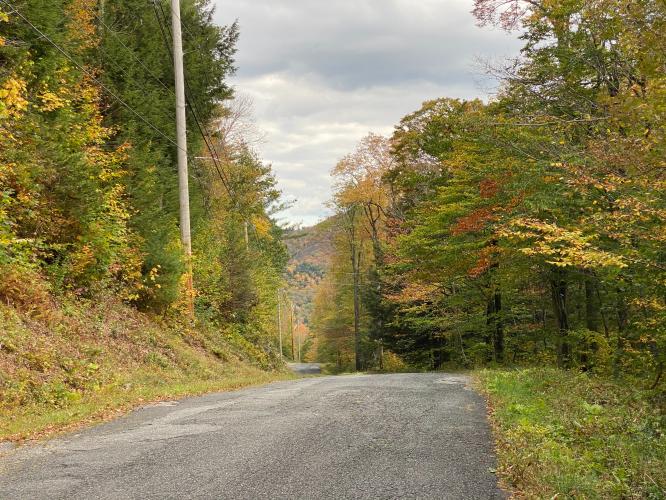
The hill begins over solid grade which only gets steeper the further west you ride. Leaving town quickly, you enter thick woods as you encounter severe grade. Soon the slope hits 20% so just keep turning the pedals to make progress. At the half mile point the grade eases, giving you a chance to catch your breath.
![Cycling Kinsley Hill Road, Massachusetts Cycling Kinsley Hill Road, Massachusetts - photo collage, fall foliage, dense forestation, one-lane mountain road, PJAMM Cycling logo in corner]()
The slope eases here but is still solid and soon you are again riding over double digit slope although not to the level of the previous section [next half mile is only 11.2%]. The woods begin to thin a bit and a road appears on the left. Keep riding straight as the grade eases as a few houses appear. Turn left at the road junction for 0.1 miles to finish over moderate grade up to an unmarked top.”
The above quote is provided with the approval of John Summerson, and is from his US bike climbing books The Complete Guide to Climbing (by Bike), 2nd Edition, p. 72, and The Complete Guide to Climbing (by Bike) in the Northeast.
![Cycling Kinsley Hill Road, Massachusetts Cycling Kinsley Hill Road, Massachusetts- bike parked in center of two-lane roadway, fall foliage, intersection, PJAMM cycling logo in corner]()
Turn left onto Main Street at mile 1.2.
Finish at unmarked high point on Main Street
![]()
That’s a wrap!

 We've partnered with Sherpa-Map.com to bring you the best route planning tool. With a PRO Membership you can use this climb as a reference when creating your route.

