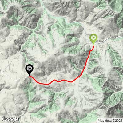
2.3
PDI
2.8 mi
DISTANCE
560 ft
GAINED
3.7 %
AVG. GRADE
FULL CLIMB STATS
INTRO
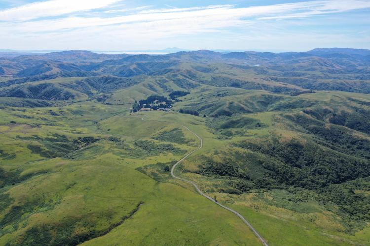
The Marshall Wall West and East climbs are located in the northwestern corner of Marin County and are quite rural and remote. The landscape is almost exclusively rugged pastureland with some views of the Pacific Ocean and Marin County's Arroyo Sausal Reservoir. This climb begins at the entrance to Walker Ranch Conference Center.
PLAN YOUR ROUTE
The average grade of this 2.8 mile climb is 3.7% (4.1% with descent eliminated). 52% of the climb is at 0-5%, 28% at 5-10% and 11% at 10-15%. The steepest quarter mile on the ascent is 11.5%.
See more details and tools regarding this climb's grade via the “Profile Tool” button above.
Roadway: Narrow 2 lane with center stripe in good condition.
Traffic: Minimal and you are just as likely to encounter dairy tankers as cars.
Parking: One space at the climb start at the entrance to the Walker Ranch Conference Center- Map; treet SView.
Provisions: There are no provisions on this climb. However, consider the deli at French Marin Cheese Factory 8.6 miles east of the start of this climb - they have great sandwiches and a nice picnic area (Map) or Inverness 20 miles south via descending into Marshall and riding down the coast (Map).
Before heading out on any cycling adventure check out our Things to Bring on a Cycling Trip and use our interactive check list to ensure you don't forget anything.
A nice out and back is this climb and Marshall Wall West - 12 miles, 1,410' (Map).
There are some great places to stay in nearby Bodega Bay. There are many great house rentals in Marin County too.
ROUTE MAP
MEMBER RATING
CURRENT WEATHER
PJAMM TRIPS ADVENTURE STARTER BUNDLES
Check out PJAMM Adventure's prepackaged (self-guided) cycling trips. They will help you plan, document and conquer your next adventure.
NEARBY CLIMBS (0) RADIAL PROXIMITY
FROM No Climbs Found
MEMBER REVIEWS & COMMENTS
Let us know what you thought of this climb. Signup for our FREE membership to write a review or post a comment.
Already have an account?
LOG IN HERE


