Towne Pass West Bike Climb - PJAMM Cycling

7.7
FIETS
9.4 mi
DISTANCE
3,412 ft
GAINED
6.9 %
AVG. GRADE

FULL CLIMB STATS

INTRO

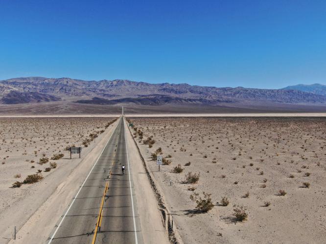
"The west side of Townes Pass is a tough desert climb that leads out of isolated Panamint Valley and into Death Valley.  From the valley floor the road eventually heads up a drainage.  The first two miles are shallow but then you must negotiate a very tough five mile stretch of over 8% grade.  The final few miles ease back to finish at signed Townes Pass (4,956 ft).  The west side of Townes Pass is more difficult than the Col d'Aspin and La Mongie, and quite similar to Luz-Ardiden; all difficult climbs that make regular appearances in the Tour de France. (This quote is presented with the approval of John Summerson, from his book, The Complete Guide to Climbing (by Bike) in California, pg. 135.)

See more details and tools regarding this climb's grade via our interactive Profile Tool.
Information Not Available

If you have any information regarding this climb, we'd like to hear from you. Click the CONTRIBUTE button to share your thoughts with us.

Information Not Available

If you have any information regarding this climb, we'd like to hear from you. Click the CONTRIBUTE button to share your thoughts with us.

Before heading out on any cycling adventure check out our Things to Bring on a Cycling Trip and use our interactive check list to ensure you don't forget anything.
We have always stayed in Stovepipe Wells at the Stovepipe Hotel and Restaurant when doing bike climbs in the western side of Death Valley. We enjoy staying at Stovepipe as it has a gas station, nice and reasonable rooms, a store, and a restaurant-bar. 
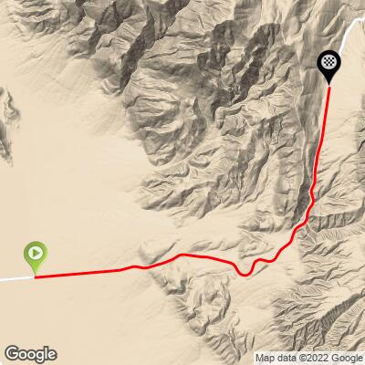
ROUTE MAP

MEMBER RATING

Difficulty: Challenging
4
Road
3
Traffic
3.5
Scenery

CURRENT WEATHER

PJAMM TRIPS ADVENTURE STARTER BUNDLES

Check out PJAMM Adventure's prepackaged (self-guided) cycling trips. They will help you plan, document and conquer your next adventure.
ALL TRIPS
Browse all of our prepackaged trips and find your next adventure!
Death Valley
United States (CA)
21 ROUTES
34 POIs
ROUTE STATS (TOTAL)
553.3
mi
DISTANCE
55,125
ft
ELEV. GAIN
Owens Valley: Bishop
United States (CA)
19 ROUTES
26 POIs
ROUTE STATS (TOTAL)
268.3
mi
DISTANCE
55,531
ft
ELEV. GAIN
Owens Valley: Lone Pine
United States (CA)
15 ROUTES
31 POIs
ROUTE STATS (TOTAL)
157.7
mi
DISTANCE
51,016
ft
ELEV. GAIN

NEARBY CLIMBS (0) RADIAL PROXIMITY

FROM
No Climbs Found

MEMBER REVIEWS & COMMENTS

Let us know what you thought of this climb. Signup for our FREE membership to write a review or post a comment.
Already have an account?

Mar 24, 2023
March 22, 2023, 25 mph crosswinds. Took me 45 minutes to ride from panamint springs gas station just to the first bend in the road on the other side of the valley. Temps just above freezing at summit, 30 mph gusts.
Nov 18, 2022
I've done both sides. The biggest issue was overheating wheels / tires on the descent thou the climbs were VERY challenging. Now I've got discs so all is well with the "go fast downhill" scenario.
Apr 30, 2021
difficulty: Challenging
scenery: 3
traffic: 3
road: 4
Apr 30, 2021
scenery: 3
traffic: 3
road: 4
Although this side has the steeper gradients, it seems easier than the East side (maybe mostly due to not being as long). If you like descending fast, this is a good one. You can start in Panamint (supplies available) or just park on the side of the valley road. As the main picture shows, the approach from the valley floor can be intimidating! Military jets like to practice at low levels in the valley which can add some excitement.
Apr 9, 2021
difficulty: Challenging
scenery: 4
traffic: 3
road: 4
Apr 9, 2021
scenery: 4
traffic: 3
road: 4
One of the many solid climbs in and around Death Valley, the west side of Towne Pass has much of the steep grades as well which are somewhat rare in the area. A very fast descent as well.
ROUTE MAP
PROFILE TOOL
Route Data
S.G. (%)
hide
Segment Data
hide

Climb Profile Not Found
CLIMB SUMMARY

x

Cycling Towne Pass West

Ride 9.3 miles gaining 3,405’ at 6.9% average grade.

For more information on this ride, and others in the area, visit PJAMM Cycling’s Death Valley National Park page.

Along with Dantes View, Towne Pass West is one of the more scenic Death Valley climbs.  The first 1.5 miles of the climb are mild, but miles 1.5-5.25 average 7.9%, with a one mile stretch from about mile 4.25 to 5.25 that averages 9.7%.  The start of the climb is pure Death Valley: what seems to be an endless stretch of straight, flat pavement is all that lies in front of us...but don’t be fooled, it's not flat!  

straight away.jpg

Riding from Panamint towards start of Towne Pass West climb.

Ground view looking towards beginning of the climb.


Looking back ½ mile from the start.

By the three mile mark we begin to leave the desert floor behind and enter more hilly/mountainous terrain, offering exceptional views of the valley to our left and behind us as we climb.  By mile six we are entering canyon-like terrain which is stark and without any appreciable vegetation and certainly no greenery -- but these stark Mars and Moon-scapes are part of the allure and beauty of Death Valley.  See this YouTube video for a true sense of this climb.

IMG_1523.JPG

Colorful surroundings as we climb.

   IMG_1531.JPG

There is a ½ mile 11.5% segment from between miles six and seven.

Well . . . after the torture comes the fun!

Summit.

Towne Pass (also called Townsend Pass in the distant past) is named after a man named Townsend who saved emigrants stranded in Death Valley in the mid 19th century.  

THE BIKE CLIMBS OF DEATH VALLEY

(From west to east)

Cycling Death Valley - Map with all bike climbs in Death Valley

Diamonds designate Top 100 US bike climbs (red 51-75 / orange 76-100 rank).

 The climbs from Panamint (Death Valley’s western entrance) to Furnace Creek (eastern exit) are:

WHERE TO STAY IN DEATH VALLEY

We have entered Death Valley both from the west (via Lone Pine, Whitney Portal, and Horseshoe Meadows; 50 miles to Panamint Springs) and Las Vegas (Kyle Canyon and Lee Canyon; 140 miles to Furnace Creek).

There are three areas with hotels in Death Valley:

  • Panamint Springs:  This is the closest hotel to the western entrance to Death Valley, which is near the southern part of the top world bike climbing area of Owens Valley. Panamint Springs is the most rustic and least expensive accommodations in Death Valley.  We have stayed at the Panamint Springs “Resort” but do prefer Stovepipe Wells and The Ranch at Death Valley. Panamint has one restaurant, a sparse store, and a gas station.

Sign at Panamint Springs Resort

The birds to the left are real.

  • Stovepipe Wells:  The Stovepipe Wells Village Hotel is our choice of places to stay in Death Valley for a couple of reasons.  First, it is less expensive than the two hotels in Furnace Creek, although a little more expensive than Panamint Springs.  Second, it is the hub for bike climbing in the valley.  All climbs are within a 25 mile straight line radius of Stovepipe (see map, below).

Entrance to Stovepipe Wells Village Hotel.

Cycling Death Valley - map with climbs in relation to Stovepipe Wells

Distance from Stovepipe Wells to all climbs.

  • The Ranch at Death Valley (Furnace Creek): If you don’t mind paying roughly $100 more for lodging and don’t mind driving a little further to your Death Valley bike climbs, this is a great place to stay.  The restaurant and store are better and the compound is very nice.  The Oasis at Death Valley is the most luxurious accommodations in Death Valley and if price is no object ($450-$500 a night), stay there.  The Oasis is just a mile from The Ranch at Death Valley (these two hotels are owned by the same company) and is the “Four Seasons” of Death Valley.  Of course, these accommodations come at a price, the Oasis is twice the cost of The Ranch and three to four times more than Panamint and Stovepipe.

Entrance to The Ranch at Death Valley.

The Ranch at Death Valley has by far the nicest store in Death Valley.

The only locations to get gas in Death Valley are at Panamint, Stovepipe and Furnace Creek -- but, buyer beware:

The math on that is $5.99 per gallon (2015 prices; 2019 were slightly less).

DEATH VALLEY WEATHER

National Park Service Death Valley Weather Chart.

As you may expect, Death Valley is dangerously hot during the day from June through September with average monthly highs during that time ranging from 106° to 116.5°.  Cycling is not recommended during the summer and certainly never without good SAG support.  The heat can be stifling (if not truly dangerous) and supplies are few and far between.  

The hottest temperature ever recorded on earth was in Furnace Creek on July 10, 1913 (134℉/56.7℃) and, while that record has been challenged, the “alternate” record is also held by Death Valley (2013 in a tie with Mitribah, Kuwait in 2016 at 129.2℉/54.0℃).

July 2017 -- Badwater to Mt. Whitney Summit.

Cycling Death Valley - pjamm cycling ride bikes through death valley

OK!  I didn’t take my own advice in July, 2017.  😨

Access to full Climb Summary requires a PJAMM Cycling PRO Membership!

It takes less than a minute to sign up & with your PRO membership you can:
  • Rate climbs, post comments and share your experiences on any of our climb pages
  • Create bucket lists of climbs & mark the dates you complete them
  • Weather data for all climbs - Start & Finish
  • Upload photos to your member page to customize your PJAMM Cycling experience
  • Utilize all of our interactive tools - Profile & Routes in Area
  • Download climb route .gpx files
LEARN MORE
SIGN UP

Already have an account? LOG IN HERE